Web map service build
We took part in building an oil refiner's web map service that shows customers fuel stations and nearby facilities across the country. Most web maps at the time slid static images around; this one chose to let people drag and zoom the map right inside the browser. Internet connections were slow, so a map that opened late or tiles that looked misaligned broke the whole point of a locator. Our part was aligning map tiles with the source map data on screen coordinates, cutting the amount of data sent, and the pan and zoom transitions.
Instead of sliding images, a map that moves inside the browser
This web map service lets customers look up fuel stations and nearby facilities across the country in their browser. Most web maps at the time moved by sliding images sideways. This service chose to take dragging and zooming directly inside the browser. We took part in building it by combining a map library with the source map data.

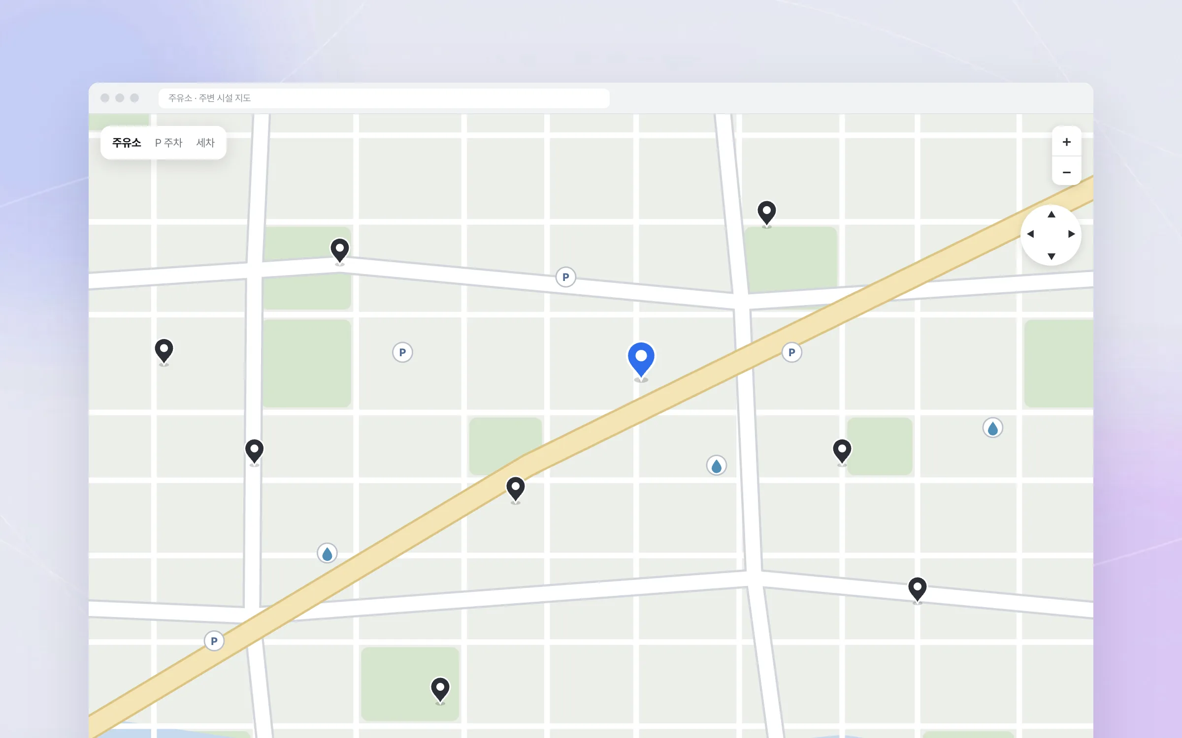
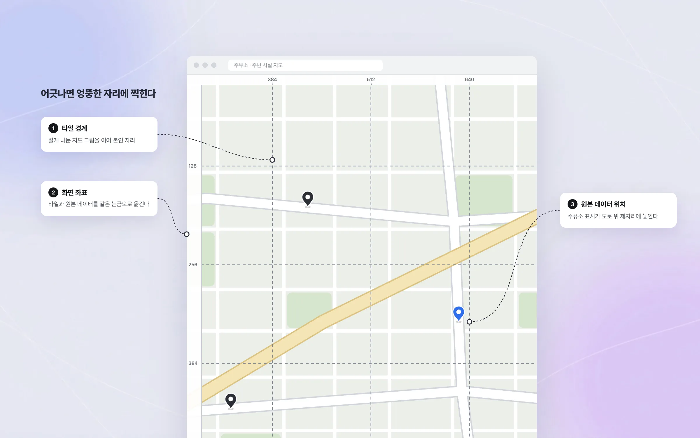
Alignment that keeps map tiles and source data in register
A web map stitches together small map images (tiles) and places positions from the source map data on top. If the two coordinate systems drift even slightly, a fuel station marker lands in the wrong place. We mapped the tiles and the source data onto the same screen coordinates, and found and corrected the map images wherever they looked misaligned on the live screens.

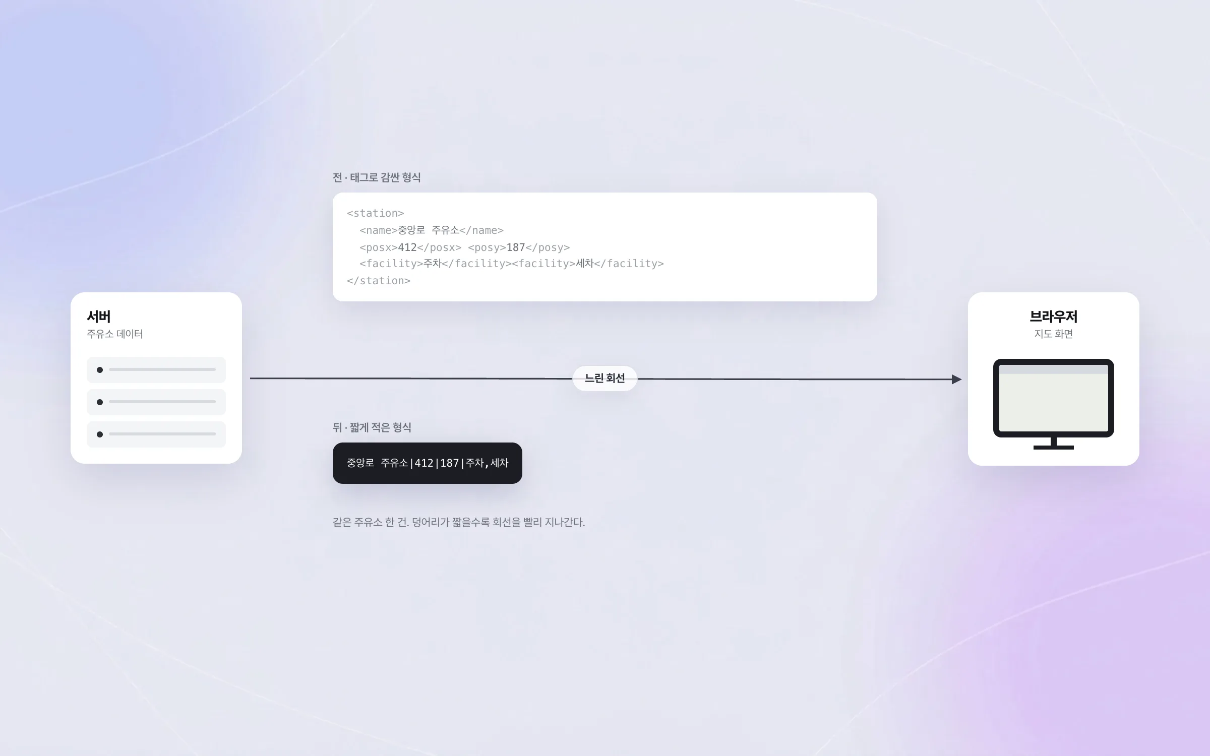
Less data sent, so the map opens on a slow connection
A web map has to fetch the data that fills the screen every time, and connections back then took real time to deliver it. We reduced the amount of map data sent and refined how it was displayed so the map would open even on slow lines. Data exchanged with the server also moved from a heavy tag-wrapped format to a more compact one, lowering the traffic.

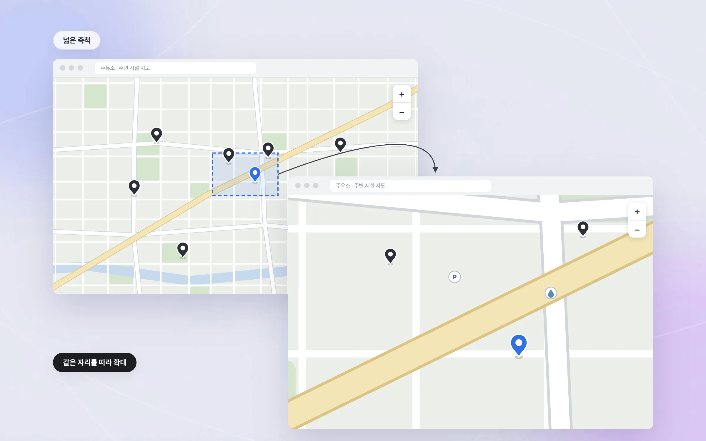
Transitions that keep your place while you drag and zoom
When dragging or zooming a map makes the screen jump abruptly, people lose track of where they are looking. We added smooth transitions to panning and zooming so users could follow their position while the scale changed. The map technology built here was later carried over to a fuel-station locator, a bus information map for new towns, and services abroad.

Highlights
A web map you drag and zoom inside the browser
Map tiles and source map data aligned to screen coordinates
Less data on the wire so the map opens on slow connections
Insights
GA4 client_storage: 'none'은 정말 쿠키를 막을까?
두 달 전 이 블로그에 「GA4 쿠키 없이 쓰기」라는 글을 썼습니다. clientstorage: 'none' 으로 쿠키 저장을 끄고, 자체 분석이 쓰던 익명 ID 를 clientid 로 넘기면 쿠키 0개로 GA4 를 쓸 수 있다는 내…
GA4 Measurement Protocol: gtag.js 없이 서버에서 이벤트 보내기
랜딩 페이지의 전송량을 파일 단위로 쪼개 보다가, 가장 큰 파일이 우리 코드가 아니라는 것을 알았습니다. Google Analytics 의 gtag.js 였고, 방문 한 번에 176KB 를 받고 있었습니다. 페이지 전체가 1,094K…
중소 제조업 AI 도입 순서: DX를 먼저 끝내야 할까?
공장을 가진 중소·중견 제조기업 16만여 곳 가운데 스마트공장을 도입한 곳은 19.5%입니다. 회사가 작을수록 이 비율은 더 떨어집니다. 중소벤처기업부가 2025년 4월에 낸 제1차 스마트제조혁신 실태조사 결과입니다. 그림: 기업 규…
Next.js loading.tsx와 404: 버튼이 화면보다 먼저 살아나게 하기
관리 화면 왼쪽 위에 사이드바를 접고 펴는 ☰ 버튼이 있습니다. 폭 하나 바꾸는 버튼인데, 대시보드에서 누르면 2초 넘게 아무 반응이 없었습니다. 레이아웃만 바꾸는 일이 왜 이렇게 오래 걸리는지부터 들여다봤습니다. Next.js 16…